
| Northern Hemisphere | Southern Hemisphere |
|---|---|
| Ice Drift - Low resolution | |
|
|
|
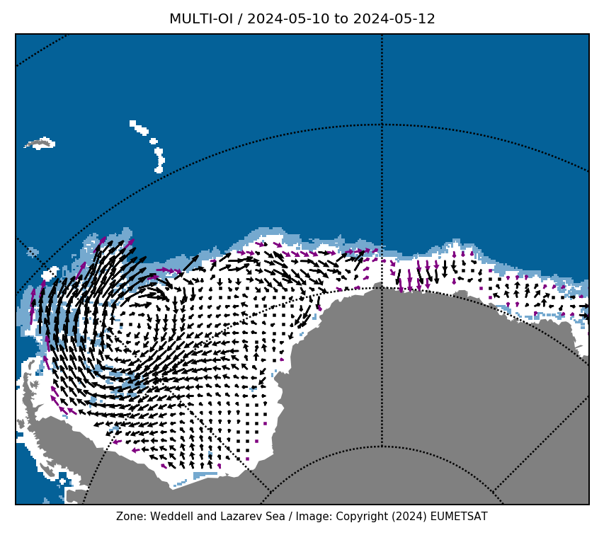
| Ice Drift - Medium resolution | |
|
|
|
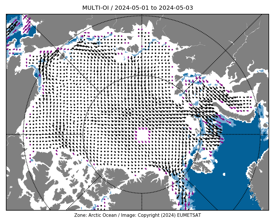
The low resolution sea ice drift product consists of ice motion vectors with a time span of 48 hours estimated by an advanced cross-correlation method (the Continuous MCC, CMCC) on pairs of satellite images. Several single-sensor products are available, along with a merged (multi-sensor) dataset. Includes ice drift vectors in summer, and maps of uncertainties.
The medium resolution sea ice drift product consists of ice motion vectors with a time span of 24 hours estimated by a maximum cross-correlation method (MCC) on pairs of satellite images. Input data are ~1km Infra Red or Visible data.
For more details on the sea ice drift products see the EUMETSAT OSI SAF webpage, including documentations, product archive and quicklooks.