
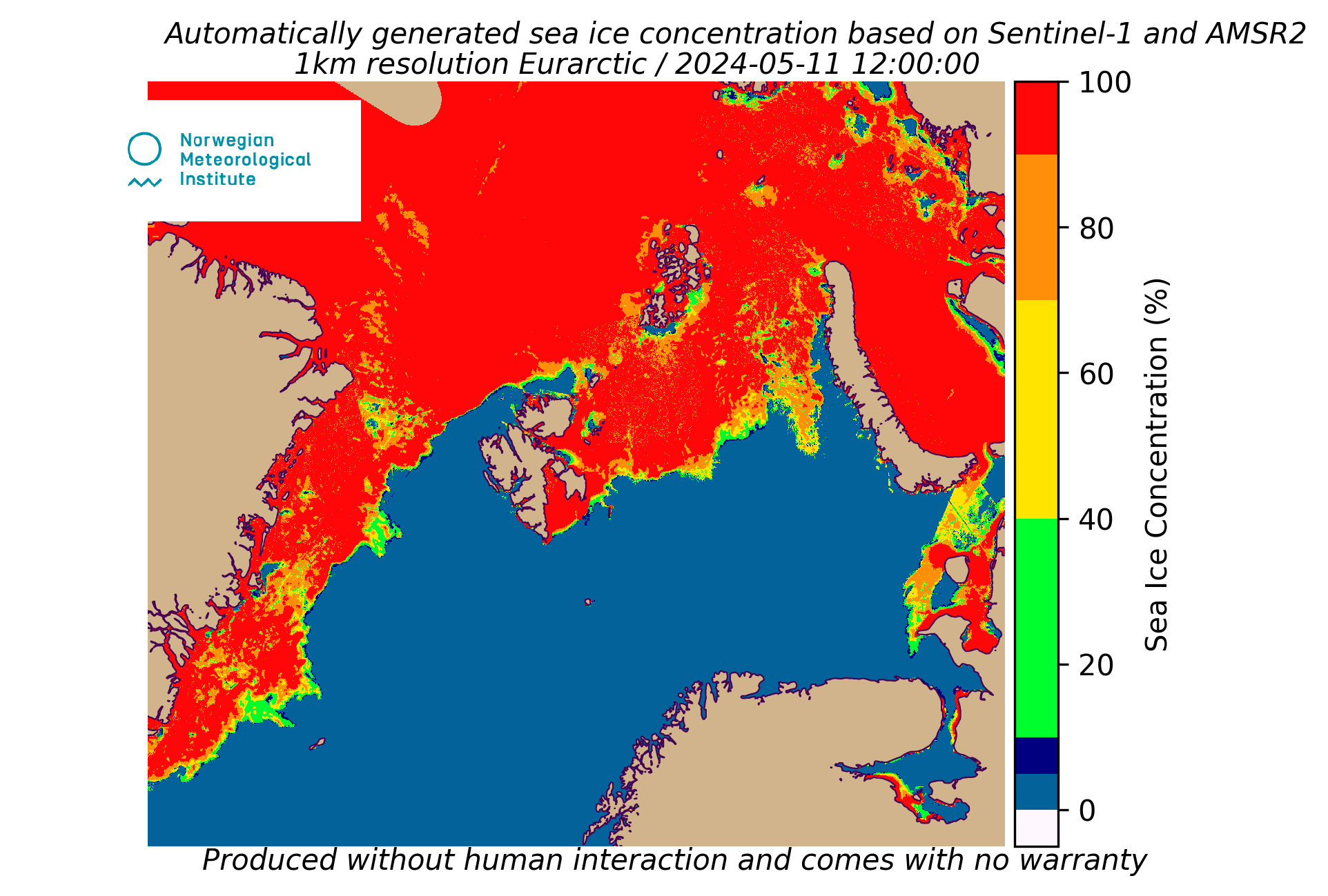
The product is produced without human interaction and comes with no warranty. Strong wind over open water may in some situations be interprated as sea ice. In additon, melt pounds on top of the ice can give a too low concentration. Please contact Frode Dinessen (froded@met.no) for more information.
This is an automatically generated sea ice concentration product based on satellite data from AMSR2 and Sentinel-1. The AMSR2 Passive Micro Wave (PMW) satellite data provides sea ice concentration at a spatial resolution of approximately 5km. The Sentinel-1 Synthetic Aperture Radar (SAR) data has a pixel spacing of 40x40 meters where each pixel is classified into ice/water. From this, the concentration is derived from the fraction of ice within an area of 1x1km. The two concentration products are then merged into a sea ice concentration product with a 1x1 km spatial resolution. The product is updated daily at approximately 12:00 UTC and utilizes the latest satellite data downloaded at MET Norway. Sentinel-1 data can be downloaded from the national datahub at NBS