
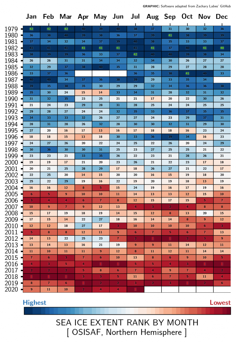
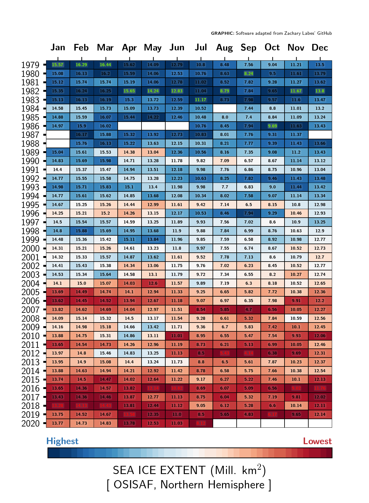
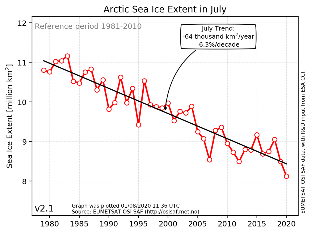
The July 2020 mean sea-ice extent is the lowest on record for this month in the 40+ years long satellite record, with an averaged value of 8.1 million square kilometers. July 2020 stole the record from July 2012. The 10 years of lowest sea-ice extent for July have all occurred since 2007.
The trend in averaged sea-ice extent for July is now at a reduction of 6.3% per decade. This corresponds to a total area of four times the size of Spain less ice than for a typical July in the 1980ies.
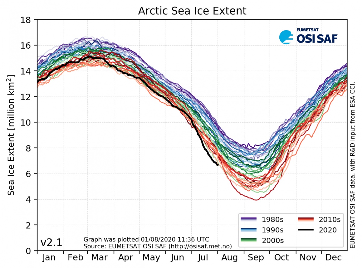
This year’s Arctic sea-ice maximum occurred on March 3 with a coverage of around 15.2 million square kilometers. The average extent for the month was 14.8 million square kilometers, placing March 2020 as the 10th lowest March on record. Since the end of March the sea-ice cover has shrunk faster than normal, leading to the second lowest April mean value on record, and the fourth lowest values for May and June. Since July 10th the daily sea-ice extent has been the lowest on record for this time of year. In mid-July the sea ice cover dropped below 8 million square kilometer, which was a typical level for the Arctic sea-ice minimum in the 80ties, but now with still two months left of the melting season. The anomaly is largest along Siberia and is caused by record high temperatures at the end of June.
Fact Box
The Arctic sea-ice cover has a natural waxing and waning with the seasons. Sea ice melts in the summer and grows during winter. The summer melt season usually begins in March and continues until a minimum is reached in September, at which point typically half of the sea ice cover from March has disappeared. Following the sea-ice minimum, the growing season starts and continues until a maximum is reached again next March. Although a large yearly change in ice cover is natural, monitoring of the sea ice with the use of more than 40 years of satellite data measurements - shows a clear decrease in the Arctic sea-ice cover - for all seasons - during this time period.
Sea-ice concentration is a parameter used to describe how densely the sea ice is packed. It is expressed by a continuous scale from completely compact ice (100%) to an open ocean with no ice (0%). When studying the sea-ice extent it is common practice to define a threshold for concentration that divides the surface into “ice” and “no-ice”.
Sea-ice extent is the area covered by a significant amount of sea ice. It is common to use 15% sea-ice concentration as the threshold to separate between “ice” and “no-ice”.
The Arctic sea-ice minimum marks the day of the year with the lowest sea-ice extent.
The Arctic sea-ice maximum marks the day of the year with the largest sea-ice extent.
The Norwegian Meteorological Institute uses satellite data to track and describe sea-ice extent on a daily basis.