
This animation shows the snow cover melting away through Easter 2019. Each daily snow cover map is based on satellite data information from the AVHRR instrument flying on polar orbiting satellites.
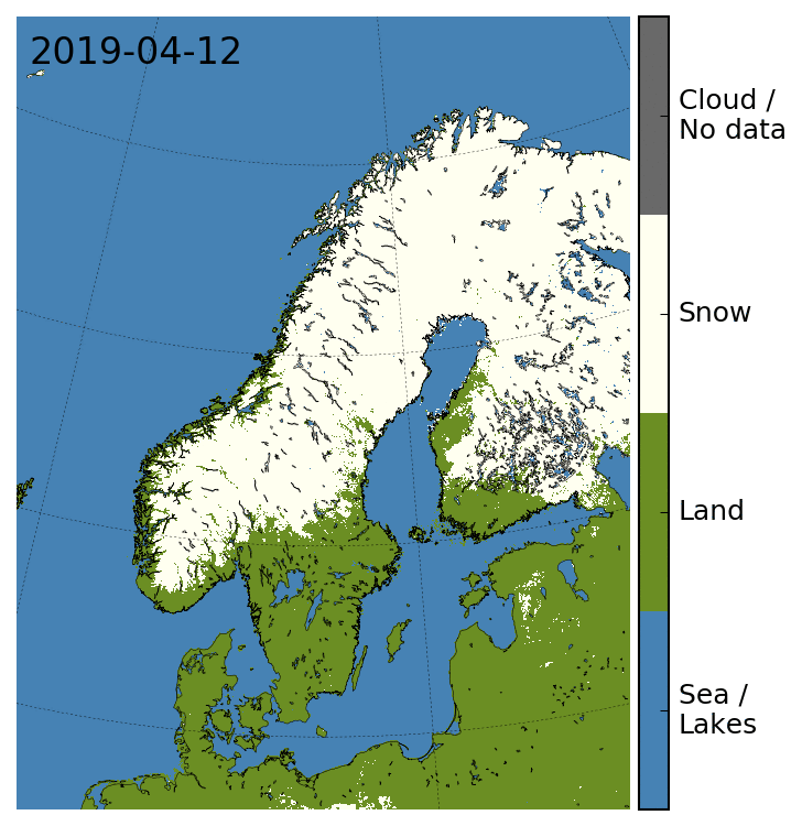
Snow is shown in white, snow-free land in green, water bodies in blue and clouds in grey. Notice that water bodies may have been covered with sea ice. This is not shown in this animation. Notice also that in each frame clouds have been removed as far as possible by using snow cover maps up to 7 days back in time to fill in for clouded areas.
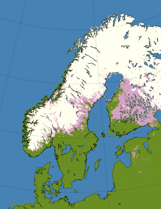
The reduction of snow cover from April 12 to April 22 is summarized by this figure. Here, the April 12 snow cover is shown in pink, while the April 22 snow cover is shown in white. Find more information about regional snow cover maps from satellite here.