
Latest satellite images used for mapping of the sea ice
(click on the image to get a larger view)
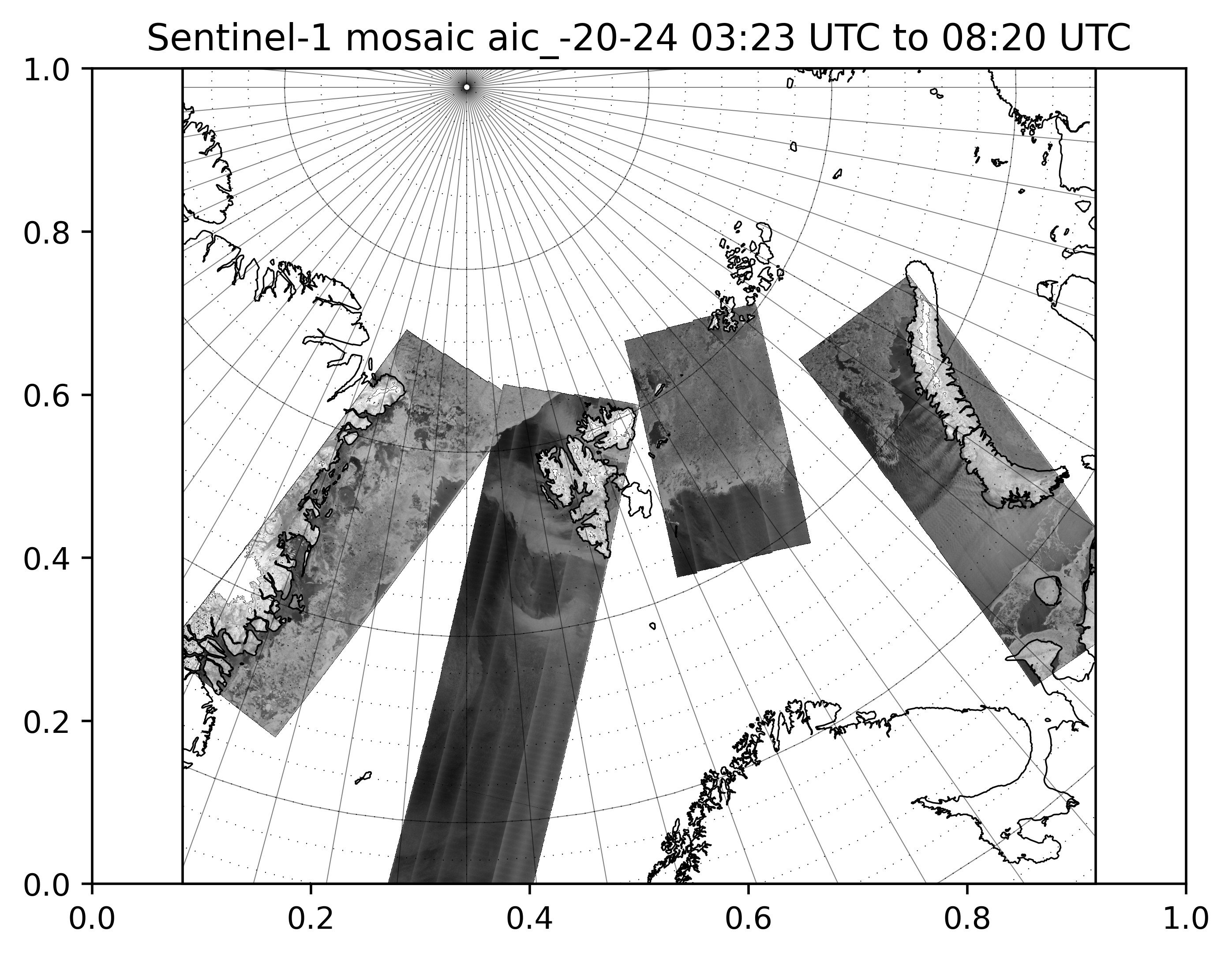
Today 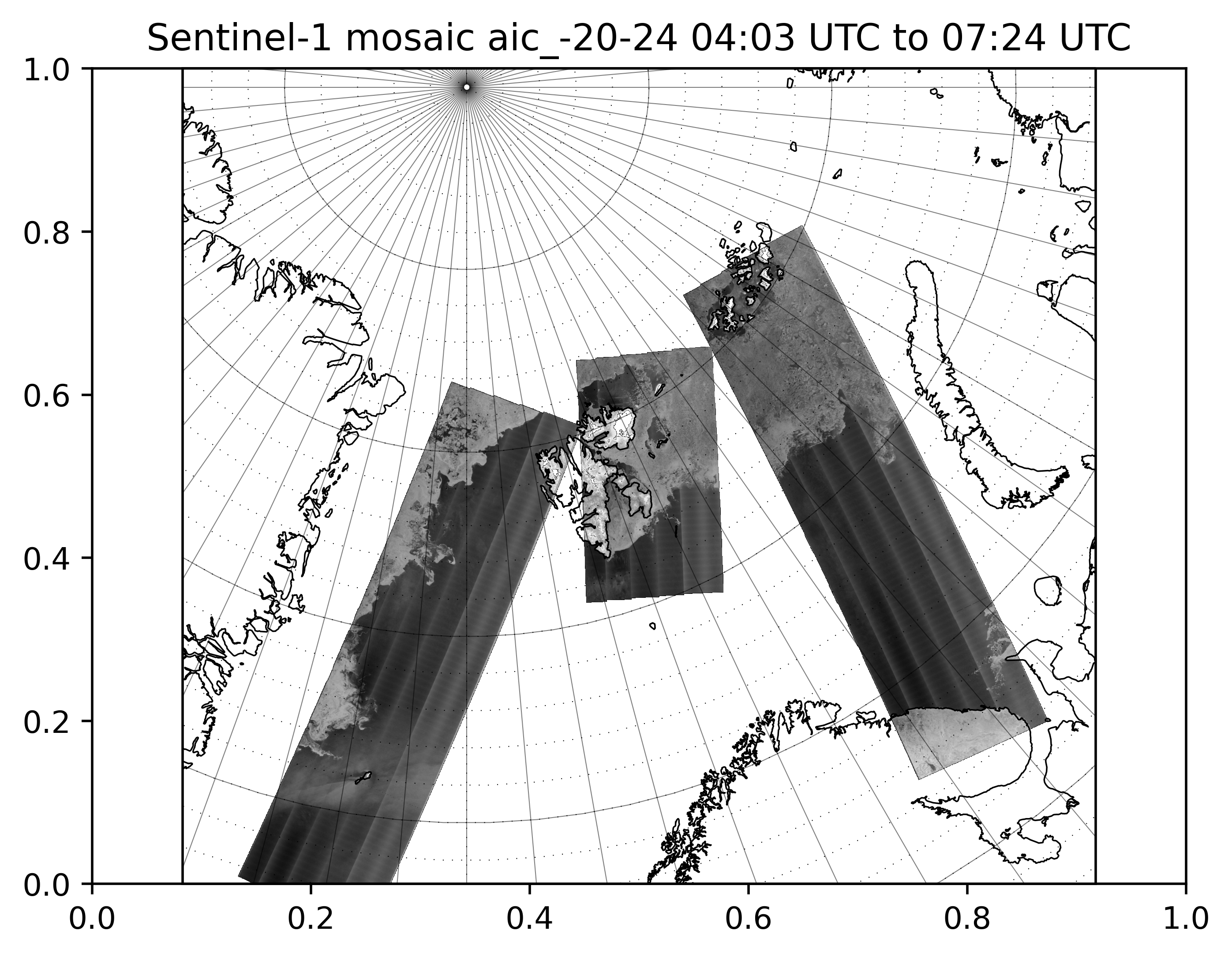
Yesterday |
The SENTINEL-1 mission includes a C-band Synthetic Aperture Radar (SAR) sensor. The SAR has the advantage of operating at wavelengths not affected by cloud cover or a lack of daylight and can acquire data over a site during day or night time under all weather conditions. It can operate in different imaging modes with resolution down to 5 m and swath coverage up to 400 km. The image shown here is recorded in Extra Wide (400 km) swath mode with a spatial medium resolution of 93x87 m and a HV-polarization. The image is updated at regular intervals throughout the day, and the latest available data are added to the mosaic. |
For access to satellite data visit satellittdata.no