
| Snow-covered area | |
|---|---|
|
|
|
|
|
|
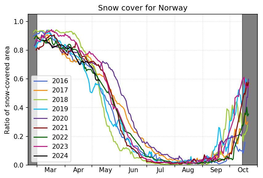
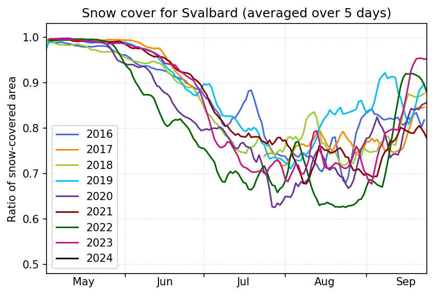
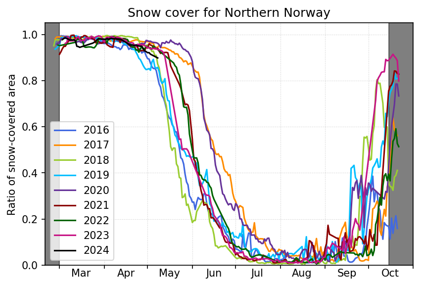
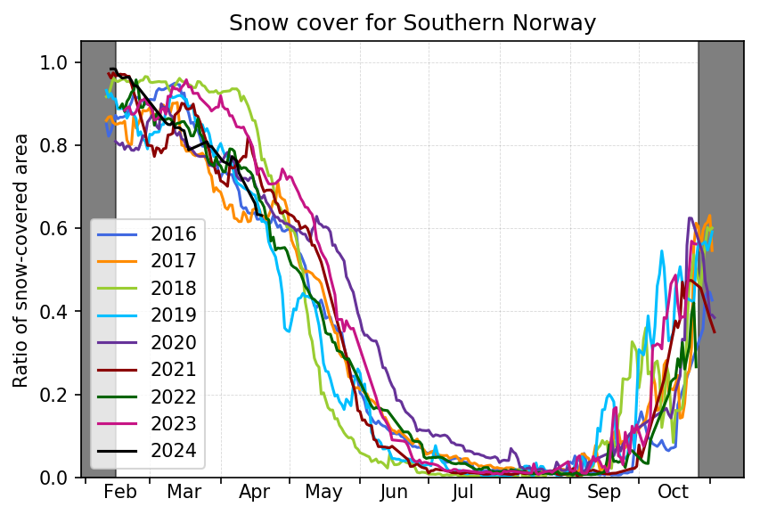
These figures show the daily total snow cover fraction for mainland Norway (top left), Svalbard (top right), Northern Norway (bottom left) and Southern Norway (bottom right). The figures are derived using data from satellite-based, daily snow cover maps. Dark gray areas indicate the time of year for which the snow cover maps due to low solar elevation / polar night do not have full coverage for the full region.
Optical satellite instruments cannot see through clouds. For areas that are clouded in today's map, we search backwards in time to the most recent cloud-free situation. This means that there can be some "delay" in the graph, in particular if large new snowfalls or extensive snow melting occurs under a clouded sky. There will also be cases of noise ("spikes") in the figures that are due to cloud-shadows that might be erroneously detected as "snow".
Click the figure to see the full image. The latest snow map can be seen here.