
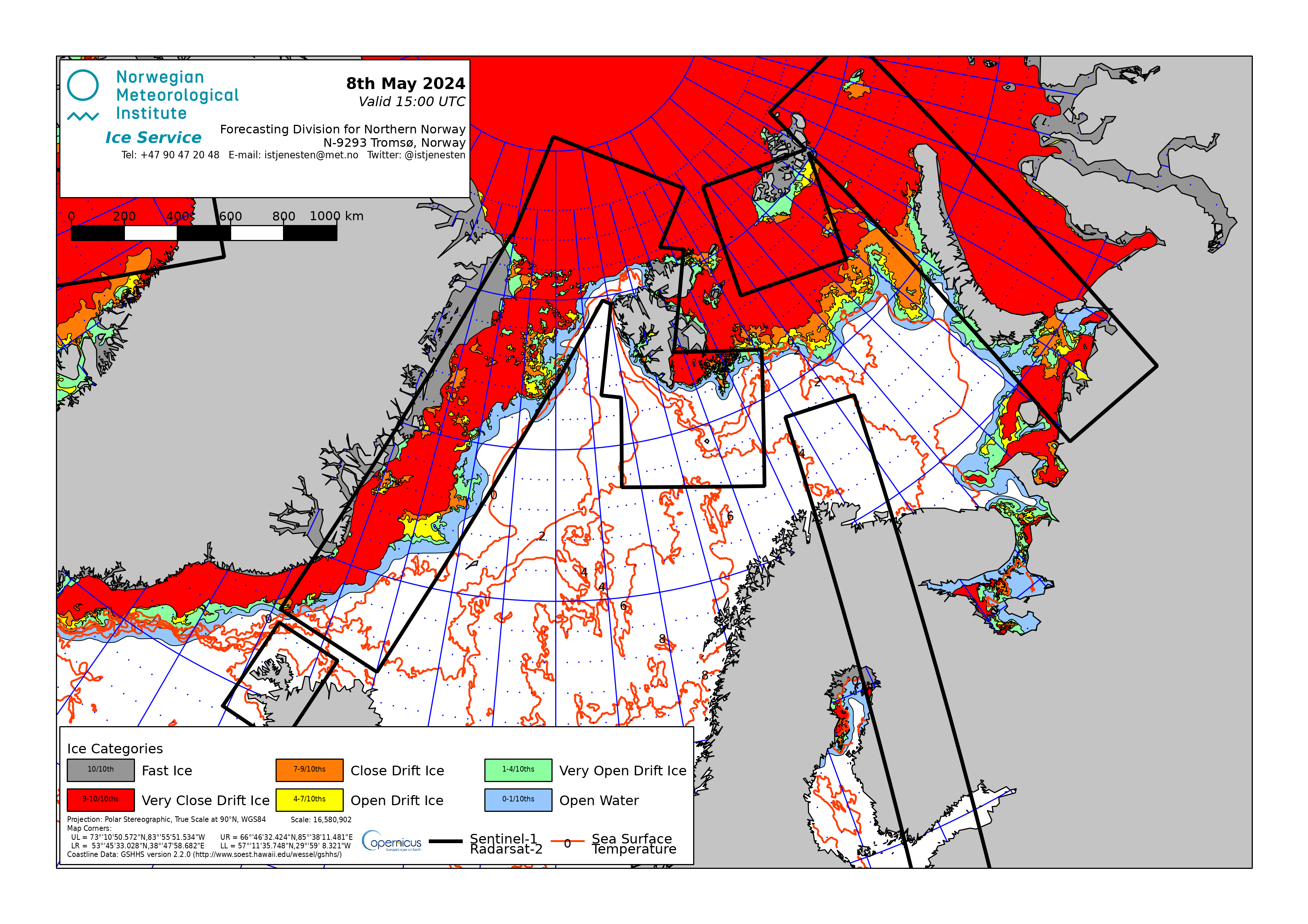
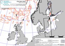
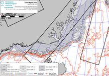
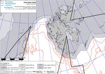
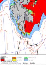
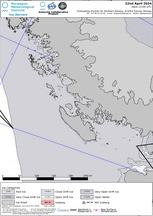
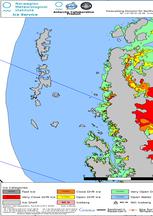
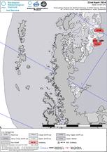
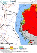
Iskartene er produsert av Istjenesten som en del av vårt operative ansvar for overvåkning av europeisk farvann. I tillegg bistår de med overvåkning i antarktisk farvann. Disse iskartene analyseres og kontrollsikres av en Ishavs Analytiker. Nye, oppdaterte iskart for Arktis er tilgjengelige på hverdager (mandag-fredag), og for Antarktis på mandager, begge etter kl 1500 UTC.
Iskartene blir også publisert som lag i BarentsWatch - ArcticInfo og er lokalisert under "Is og vær" i temavelgeren. Iskartene er også tilgjengelig i shape-format (4 filer: SHP, SHX, DBF og PRJ) eller zipped Sigrid-3 shapefile (zip) for visning i GIS-programvare eller via API.
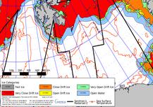
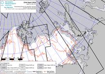
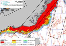
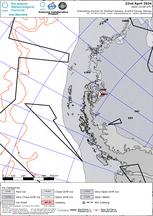
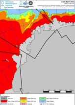
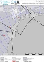
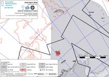
Iskart over Arktis
| Område | Bildeformat | Gråtone | ||||||
| Generelt |
|
|
|
|
|
|
|
|
| Baltiske hav |
|
|
|
|
|
|
|
|
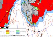
| Barentshavet |
|
|
|
|
|
|
|
|
| Danmarkstredet |
|
|
|
|
|
|
|
|
| Framstredet |
|
|
|
|
|
|
|
|
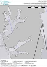
| Isfjorden |
|
|
|
|
|
|
|
|
| Oslofjorden |
|
|
|
|
|
|
|
|
| Svalbard |
|
|
|
|
|
|
|
|

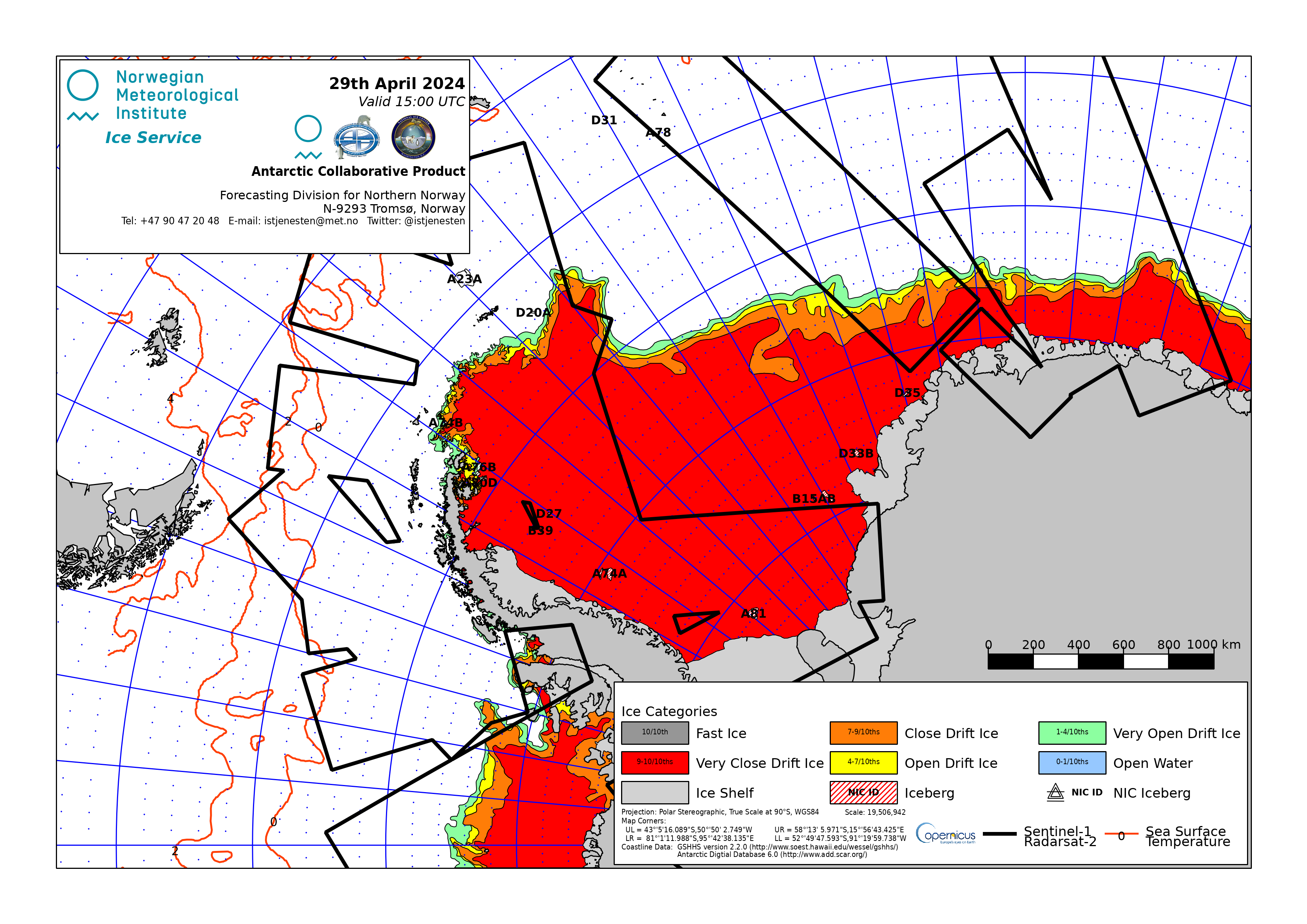
Iskart over Antarktis
| Område | Bildeformat | Gråtone | ||||||
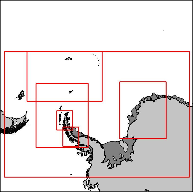
| Antarktis |
|
|
|
|
|
|
|
|
| Adelaideøya |
|
|
|
|
|
|
|
|
| Bransfieldstredet |
|
|
|
|
|
|
|
|
| Antarktishalvøya |
|
|
|
|
|
|
|
|
| Weddellhavet - Øst |
|
|
|
|
|
|
|
|
| Sør-Georgia |
|
|
|
|
|
|
|
|
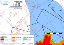
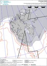
Iskartene for Antarktis blir laget mellom oktober og april, som et samarbeid mellom Istjenesten ved Meteorologisk institutt, U.S. National Ice Center (NIC) og Russian Arctic and Antarctic Research Institute (AARI). Et arkiv er tilgjengelig hos AARI.